Overview
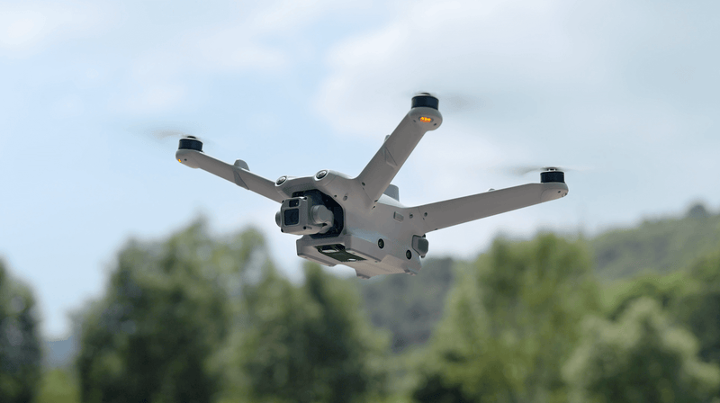
The DJI Matrice 3D is a compact, dock-compatible enterprise drone purpose-built for autonomous mapping, surveying, and inspection missions. Designed to pair seamlessly with the DJI Dock 2 for fully remote, unattended operations, the M3D brings persistent aerial intelligence to infrastructure, construction, and resource management applications. Its mechanical shutter camera captures distortion-free images critical for photogrammetric accuracy.
The M3D features a 4/3 CMOS wide-angle camera with a 20 MP mechanical shutter and a medium tele camera with 56x max hybrid zoom, enabling both broad-area surveys and detailed close-up inspections. With up to 43 minutes of flight time, IP55 weather protection, and centimetre-level RTK positioning built in, the M3D delivers survey-grade results in challenging environments.
Fully integrated with DJI FlightHub 2, the M3D supports remote mission planning, automated flight execution, and cloud-based data management. When deployed with the DJI Dock 2, it enables 24/7 autonomous operations with automatic battery charging, weather monitoring, and remote health diagnostics — transforming how organisations manage recurring inspection and mapping workflows.
| Specification | Details |
|---|---|
| Takeoff Weight | Approx. 920 g (with battery) |
| Dimensions (Unfolded) | 347 × 373 × 130 mm |
| Max Flight Time | 43 min |
| Max Speed | 21 m/s |
| Max Wind Resistance | 12 m/s |
| Transmission System | DJI O4 |
| Max Transmission Range | 20 km (FCC) |
| Wide Camera | 4/3 CMOS, 20 MP, mechanical shutter, equiv. 24 mm |
| Medium Tele Camera | 1/2" CMOS, 48 MP, 56x max hybrid zoom |
| RTK Positioning | Built-in, cm-level accuracy |
| Obstacle Sensing | Omnidirectional (forward/backward/left/right/up/down) |
| IP Rating | IP55 |
| Operating Temperature | -20°C to 50°C |
| GNSS | GPS + Galileo + BeiDou + GLONASS |
| Dock Compatibility | DJI Dock 2 |
| Internal Storage | 256 GB |
| Photo Format | JPEG / DNG (RAW) |